
CAMARILLO, Calif.–(BUSINESS WIRE)–ALERTWildfire, a consortium of three universities — The University of Nevada, Reno (UNR), University of California, San Diego (UCSD), and the University of Oregon (UO) — announced today it has officially partnered with California-based Telecom, GeoLinks, to deploy Wildfire Detection, Prevention, and Situational Awareness Systems across the state of California. With ample endorsement from the United States Forest Service (USFS), the Bureau of Land Management (BLM), California’s new Governor-elect Gavin Newsom, and a multitude of utilities and state counties, the project demonstrates the future and next step in advanced firefighting and suppression.
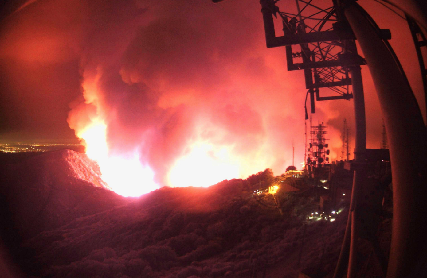
Demand for the rapid system expansion was inspired by a new wildfire camera pan-tilt-zoom technology (PTZ), developed by Graham Kent, Director of the Nevada Seismological Lab at the University of Nevada, Reno, that became instrumental in both the response and containment of the 2017 Lilac Fires in San Diego County. GeoLinks plans to deploy 28 additional PTZs by year’s end.
“ALERTWildfire is excited to work with GeoLinks as their resilient communications network throughout California enables a rapid deployment of fire cameras in critical regions of the state,” said Kent. “No other service provider is able to scale to this urgent task, and we look forward to dozens of cameras to be installed month-after-month as we ready ourselves for December 2018 and fire season 2019.”
Collocated across GeoLinks’ vertical assets in greater LA-Metro, Orange County, Riverside County, and Ventura County, the data collected from the PTZ cameras will be backhauled over GeoLinks’ ClearFiber™ network to WIFIRE at the San Diego Supercomputer Center in UC San Diego. WIFIRE, an integrated system for wildfire analysis, analyzes data collected from these cameras to create real-time simulations, wildfire path predictions, and visualizations of wildfire behavior. Ultimately, the system will provide strategic advantages for early fire detection, situational awareness for first responders, fire mapping, predictive simulations, and evacuation planning.
UC San Diego has already identified the next wave of key sites for GeoLinks to connect post initial project completion. Skyler Ditchfield, co-founder and CEO of GeoLinks, notes that with the comprehensive coverage of fixed wireless broadband that will accompany the camera network, LTE-based data connectivity and the extension of all first responder handheld radio systems can be efficiently added to close all connectivity gaps.
“The fact remains that California is now faced with wildfires year-round,” stated Ditchfield. “Wildfire detection, prevention, and situational awareness systems provide a solution that could make an immediate, lasting, and radical impact on the spread of fires and associated costs, damages, and casualties. GeoLinks, ALERTWildfire, and a variety of other affiliates across the state, including CENIC, are actively pushing the state-wide expansion of these technologies. If we had assets installed prior to the Camp Fire’s ignition, for example, we could have saved countless lives. This is really the future and next step in advanced firefighting and suppression.”
For media inquiries or interview requests, please contact Lexie Smith at [email protected].
About ALERTWildfire
ALERTWildfire is a consortium of three universities — The University of Nevada, Reno (UNR), University of California, San Diego (UCSD), and the University of Oregon (UO) — providing access to state-of-the-art Pan-Tilt-Zoom (PTZ) fire cameras and associated tools to help firefighters and first responders: (1) discover/locate/confirm fire ignition, (2) quickly scale fire resources up or down appropriately, (3) monitor fire behavior through containment, (4) during firestorms, help evacuations through enhanced situational awareness, and (5) ensure contained fires are monitored appropriately through their demise.
About GeoLinks
Headquartered in Southern California, GeoLinks is a leading telecommunications company and competitive local exchange carrier (CLEC) public utility, nationally recognized for its innovative Internet and Digital Voice solutions. Ranked first in category on Inc. Magazine’s Inc. 5000 Fastest Growing Companies in America in both 2017 and 2018, GeoLinks delivers Enterprise-Grade Internet, Digital Voice, SD-WAN, Cloud On-ramping, Layer 2 Transport, and both Public and Private Turnkey Network Construction expertly tailored for businesses and Anchor Institutions nationwide.
GeoLinks’ accelerated success is largely due to its flagship product, ClearFiber™, which offers dedicated business-class Internet with unlimited bandwidth, true network redundancy, and guaranteed speeds reaching up to 10 Gbps. Named “Most Disruptive Technology” in the 2018 Central Coast Innovation Awards, GeoLinks’ ClearFiber™ network is backed by a carrier-grade Service Level Agreement boasting 99.999% uptime and 24/7 in-house customer support. With an average installation period of 4 to 7 days, GeoLinks is proud to offer the most resilient and scalable fixed wireless network on the market.